|
|
Small Finds |
| Site Summary | ||||||||||||||||||||||||||||||||||||||||
|
||||||||||||||||||||||||||||||||||||||||
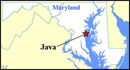
Site History Site 18AN339 has been continuously occupied since 1652 when Thomas Sparrow I patented the parcel and called it “Sparrows Rest”. The Sparrow family ran a productive plantation at the site for four generations. Thomas Sparrow II died in 1675, and two dwellings were mentioned in his will. The first reference orders his heirs to complete “the building now begun upon my now dwelling plantation…with all Convenient Speed”. The second reference stated that his sister, Elizabeth, should be allowed to live on the parcel of land containing the “timber house”. Archaeology has suggested that at least one of these earthfast structures likely stood through the early eighteenth century and the ownership of Thomas Sparrow III. In 1747, Thomas Sparrow IV sold all of his ancestral lands to Nicholas Maccubbin, a wealthy Annapolis merchant-planter who called the property “Squirrel Neck”. A ca. 1750 brick Georgian mansion was erected during the Maccubbin ownership of the land. Nicholas Maccubbin, and later his son, James Carroll (who was born James Maccubbin but changed his name in order to inherit his maternal uncle Charles “the Barrister” Carroll’s estate), turned Squirrel Neck into one of the largest and most successful plantations in the Rhode River watershed, and at least 40 slaves were working the farm by 1798. John Contee, a wealthy Prince George’s County landowner and War of 1812 hero, bought the plantation in 1819 and called it “Java” in honor of a British ship captured and destroyed during his service aboard the U.S.S. Constitution. The Contee family owned the land through much of the nineteenth century. An 1840 inventory of the plantation lists 84 slaves and 70,000 pounds of tobacco. However, after the Civil War and the demise of the slave economy, Java plantation fell into disrepair and was no longer profitable. Contee heirs sold the property in the 1880s to a wealthy northern businessman, who used it as a summer home. In 1890, the old mansion was struck by lightning. It was never fully repaired, and by the 1920s it was uninhabitable. One single family owned the land for the next 90 years, and while they did little to preserve the mansion, they also did nothing to speed its demise. The Smithsonian Environmental Research Center (SERC) obtained the property in 2008 and has attempted to stabilize what remains of the mansion, now little more than two brick chimneys.
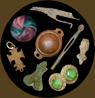
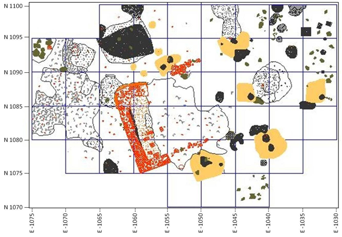
Archaeology The Anne Arundel County Lost Towns Project began intensive archaeological investigations at the Java site in 2006. During that summer, 31 shovel test pits and three 5ft by 5ft units were excavated (Cox et. al. 2007). This initial survey, coupled with a 2007 magnetometer survey, narrowed the focus of excavations to an area of the site located about 100ft from the mansion ruins. A mix of seventeenth and eighteenth century architectural, kitchen, and personal artifacts was recovered in this area, along with what appeared to be subsurface features. After excavating 25 5ft by 5ft units in 2007, a seventeenth century house site associated with Sparrows Rest had been identified (Sperling 2008). The 2008 season further explored the Sparrows Rest concentration, and an additional 27 5ft by 5ft units were excavated, along with several features. Highlights of these excavations include the delineation of a 16 ft by 20 ft timber-built (or earthfast) dwelling with a substantial brick chimney on the western gable end. Three large and deep trash-filled pits (or root cellars) were identified and tested within the interior of the house plan, along with pits and features filled with colonial trash on the exterior of the house. These archaeological features are pristine, retain archaeological integrity, and have seen little disturbance over the years, thus providing a wealth of artifacts to study and interpret as we strive to better understand the early colonial plantation life of the multi-generational Sparrow family. In 2010, an additional 193 shovel tests were systematically excavated across site 18AN339. This was done in cooperation with SERC, who obtained a grant from the State of Maryland/Maryland Heritage Areas Authority to survey the potential archaeological resources of the entire site. A small concentration of seventeenth century artifacts was found in the front, or waterside, yard of the mansion, prompting the excavation of a single 5ft square in the vicinity. No features were noted, but several more period artifacts were found. An additional nine 5ft squares were also excavated around the exterior of the Sparrows Rest house. Two new cultural features were identified and documented: the continuation of a large trash filled trench feature that was identified and tested in 2008, and a narrow, shallow trench that may indicate water management or perhaps a roof drip line associated with an extension of the core of the timber house (Cox et. al. 2011). Summary by Stephanie Sperling References
|
||||||||||||||||||||||||||||||||||||||||

|

|


